One of the most time consuming things, when starting out on with this hobby, was deciding where to collect checklists.
Why was this even a question?
Well, it comes down to what the NZ Bird Atlas is about:
- collecting data through all habitats in a grid square (but what are those habitats, and what is the minimum size units that should be considered?)
- what methodology is applied to data collection
- time on site
- how many checklists per habitat type
- etc
- repeating that effort through the four seasons
- verifying that grid squares are completed
- understanding where others are collecting checklists
The bird atlas field guide says:
“Atlas participants are completely free to choose where they go birding – you could collect atlas data in your own backyard, your local park, or from your favourite national park or island reserve. Every checklist will make an equally important contribution to the New Zealand Bird Atlas, regardless of where it is collected.”
It also goes on to say:
“To completely survey each grid square, observers should aim to visit each of the accessible, major habitat types in each grid square and collect at least one complete bird species checklist from within each habitat type. A complete checklist is one in which all of the bird species that were encountered and identified in the field are recorded, along with the date, time of day, location and time spent searching. Observers are free to not only choose which grid squares to survey, but also to choose how they go about surveying habitats within squares. Checklists can either be submitted as stationary or travelling counts, and the observer is free to choose how long to spend surveying any particular habitat.”
So, this addresses some of the questions about method.
But there are some information gaps that need to be filled:
- How does a person figure out what all the habitat types are in a grid square? This is not provided through the eBird website
- Will different observers agree on the habitat types?
- What habitats have others already collected bird checklists for?
- If I am going to collect a bird checklist in a grid square I haven’t been to before, where would my effort best be spent?
In an attempt to address these questions, I have made a map, and from that map I am going to discuss one site in the context of an entire grid square.
First, the map.

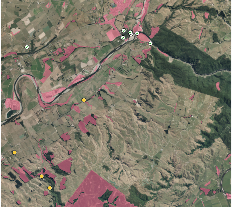
This is an aerial photo of grid square BO75. The Manawatu River flows from right to left through the top half of the photo. The village of Ashhurst, where the river exits the Manawatu Gorge and changes to a south westerly heading, has a number of bird checklists (ticked circles) evident in the domain, and along the river. The yellow dots represent bird checklists that my partner and I have collected. The areas highlighted in pink show habitats that still need checklists.
Right, with that map we can now start answering some of the questions above.
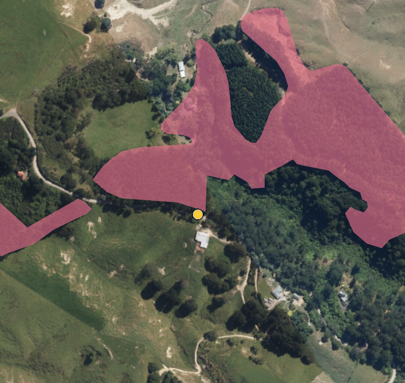
Now, the site - this is located in the bottom left-hand corner of the map above. Zooming in…

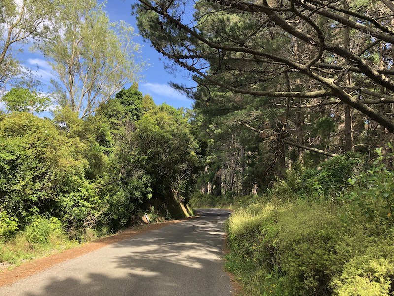
On the ground, the site is located along the road, in what is mix of Pine and other deciduous hardwoods and evergreens. The map shows a pine forest unit to the north and pasture to the south. The location along the road falls in to the pasture habitat (according to the landcover database).
The checklist location is really a transition between pasture and pine forest, but with the mix of vegetation, and the proximity of native bush further up the road, there are a mix of species present.
We have collected three checklists at this site to date - one each in winter, spring and summer.
Why did we choose this site? Initially, we were just looking to count birds in locations that others would not necessarily visit. We had looked at buying a house on this road, and on that basis, decided to count birds along it. We chose this site because the habitat had changed from the bottom of the road, and there was a big enough pull-in area that wasn’t too wet to park on (it was winter, and that was a consideration).
So, on the basis that we could chose anywhere, it seemed as good a place as any.
To be continued…
